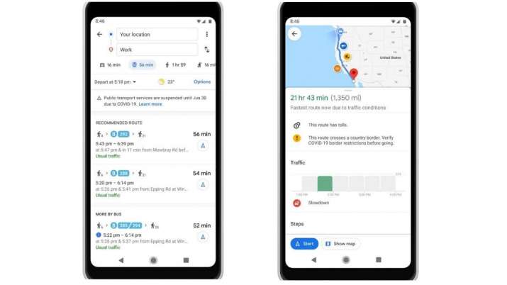
Google Maps has been one of the best online navigation apps that are internationally used by people to navigate from one place to another. Google Maps is so popular as it has been one of the most reliable platforms in its category. Now Google Maps is adding a new feature to the existing app, which would allow the user to see Covid-19 infected areas and decide the route based on that. The new feature from Google Maps shows the number of COVID cases in an area and gives a selection to the users to go on the existing route or select an alternate one that does not go through the infected area.
The feature has been added to the platform this week and will inform the users on what to do and where to go. The feature has initially been launched in the US market and the data regarding the active COVID cases have been taken from multiple authoritative sources, John Hopkins, the New York Times, and Wikipedia. All these sources get the data from the WHO (World Health Organisation), government health ministries, along with state and local health agencies and hospitals.
The new feature allows the users to see the number of COVID patients in the area by tapping on the layers button. The user will be able to see a seven day average of the infection rate and on whether it has decreased or increased. There will also be a color-coding option to distinguish between highly affected areas and normal areas.
